According to the monitoring of the Central Meteorological Observatory, Super Typhoon “Doksuri” made landfall along the coast of Jinjiang, Fujian Province at 9:55 am on July 28. The maximum wind force near the center was level-15 (50m/s), making it the strongest typhoon to make landfall in China this year. It’s the second strongest typhoon to make landfall in Fujian by complete observation records. During the typhoon's transit period, entrusted by the superior department, Leice team quickly allocated nearly 20 sets of land-based and offshore floating wind lidars in the waters of Fujian and near the landing points, achieving land and marine joint-observation for the first time. It successfully tracked and observed Typhoon "Doksuri", and obtained accurate, complete, and valuable three-dimensional observation data of the strong typhoon. Leice team overcame many difficulties such as time constraints, implementation difficulties, and equipment transportation difficulties, and completed the "almost impossible" task, receiving unanimous recognition and praise from customers.
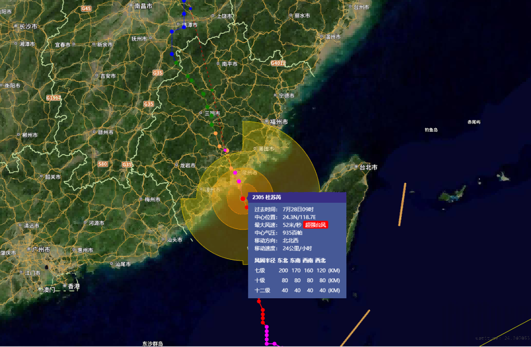
Trajectory and Intensity Information of Typhoon "Doksuri"
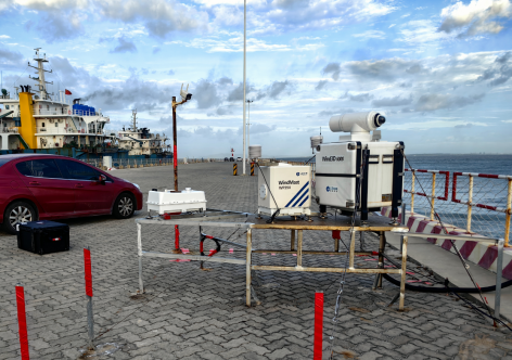

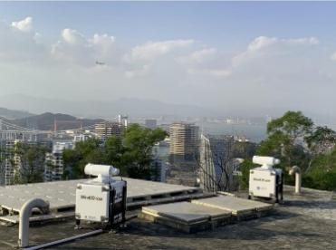
The joint-observation at land and sea has been achieved for the first time, through the three-dimensional observation network of Leice’s wind lidars
The WindMast 350-MB floating wind lidar system deployed in Fujian, located in the vicinity of the center path of the typhoon, successfully withstood the frontal impact of the typhoon. At an altitude of 240m, the maximum observed 10min average wind speed reached 42.4m/s. Under extremely complex and harsh sea conditions, the data acquisition rate of the floating wind lidar system at various observation heights has reached 100%, and modules such as the lidar, power supply, satellite communication, positioning and attitude determination, aviation support, and hydrological monitoring are all in stable operation. After more than ten severe typhoon tests such as "Typhoon Mekkhala"2020, "Super Typhoon Rai"2021, "Severe Typhoon In-Fa"2021, "Severe Typhoon Muifa"2022 and "Typhoon Talim"2023, Leice’s floating wind lidar system has once again completed the "big test" of extreme weather and adverse sea conditions with excellent results.

Wind speed variation curve at various observation heights of floating LiDAR at sea during typhoon process

Data acquisition rate at different heights of floating LiDAR at sea during typhoon process
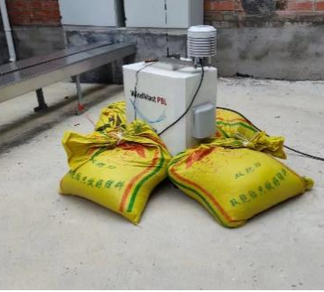
Simultaneously, the ground-based wind lidar observation network near the landing point successfully recorded the refined structure characteristics of the Planetary boundary layer wind field when the typhoon landed. According to the data records, the instantaneous wind speed on the most continent reached 51.4 m/s, and the cloud aerosol structure characteristics before and after the typhoon landed were also synchronously captured by the lidar, providing important and valuable first-hand information for the study of typhoon dynamics.
The results indicate that relying on land-based and sea-based wind lidar three-dimensional observation networks to track and observe the Strong Typhoon "Doksuri" is a successful attempt, providing strong support for typhoon related scientific research and engineering applications. In the future, Leice team and Ocean University of China will continue to work closely with relevant departments and scientific research institutions to further promote the construction of China's "Ground-Ocean-Air-Space" 3D Lidar observation network, contribute to China's marine energy development, further improve the monitoring and forecasting level of marine meteorological disasters.