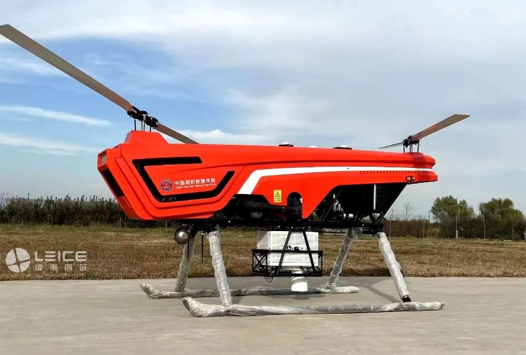
Wind measurement LiDAR mounted on unmanned aerial vehicle platform
Recently, the unmanned airborne wind lidar system jointly developed by Qingdao Leice Transient Technology Co., Ltd. and Ocean University of China has successfully passed the acceptance of China Fire Rescue College under the Ministry of Emergency Management. The project achievements have been unanimously praised by the acceptance expert group. It is also the first unmanned airborne wind lidar system applied in the field of Wildfire suppression in China.
As the saying goes, fire borrows wind power, and wind assists fire power. Wind is a crucial factor affecting fires, while traditional meteorological observation methods are limited in forest fire sites. Through the development of the unmanned airborne wind lidar system, the three-dimensional wind field information at the forest fire scene is quickly and accurately obtained, especially the real-time dynamic wind field information of the fire environment in complex terrain, which is of great significance to the fire Dynamic simulation, fire situation research and judgment, and on-site emergency command and decision-making.
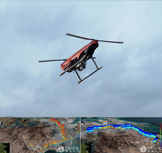
Unmanned Aerial Vehicle Flight Experiments and Data Products
In the face of tight time and heavy tasks, the R&D teams of Qingdao Leice and the Ocean University of China worked overtime to overcome difficulties, successfully breaking through many key technologies such as airborne wind measurement lidar miniaturization, lightweight, ultra-low power consumption, strong vibration resistance, real-time speed and attitude correction, remote communication and data transmission, and successfully completed the project tasks.
Leice will always adhere to the development concept of "highly focused, multi-dimensional innovation, integration of production and research, and mutual promotion and progress", closely focusing on national strategic needs, and contributing to China's green, safe, and high-quality development by creating a "ground sea air sky" three-dimensional remote sensing comprehensive solution.