On April 28, 2022, "Peak Mission 2022 - Comprehensive Scientific Expedition and Research in the Very High Altitude Area of Mount Everest" was fully launched in the Mount Everest area. On May 4th, the scientific expedition climbers successfully reached the summit and launched a number of scientific expedition missions on the summit. This is the first time in my country to break through the altitude of more than 8,000 meters and complete the comprehensive scientific expedition mission to the summit of Mount Everest. The comprehensive scientific examination is of great significance. The nationally produced Doppler wind Lidar independently developed by Qingdao Leice Transient Technology Co., Ltd. provided refined three-dimensional wind field, clouds and aerosols and other meteorological observation data from the ground to the height of Mount Everest for this scientific expedition. The successful summit of the test team provided a strong meteorological guarantee.

CCTV "News Live Room" program special report
In extremely high altitude areas, the weather is severe and changeable, and accurate monitoring and forecasting of meteorological parameters is crucial for the smooth development of scientific expeditions. The "Westerly-Monsoon Synergy and Influence Team" composed of the Qinghai-Tibet Plateau Research Institute of the Chinese Academy of Sciences, the Chinese Academy of Meteorological Sciences, and the Tibet Autonomous Region Meteorological Bureau is the authoritative team of experts to undertake the task of meteorological support for the Mount Everest scientific expedition. Two main tasks are guaranteed this time, one is to use high-tech equipment such as wind-measuring lidar, microwave radiometer, radio sounding system to carry out atmospheric vertical detection; Forecast and provide meteorological support services for mountaineering scientific expedition teams.
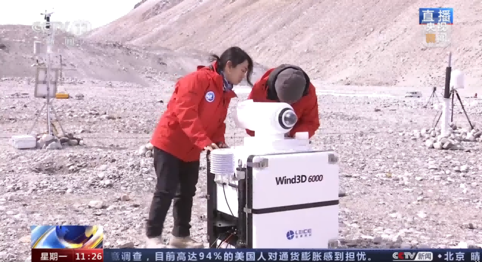
Scientific expedition members set up Doppler wind Lidar at Mount Everest Base Camp
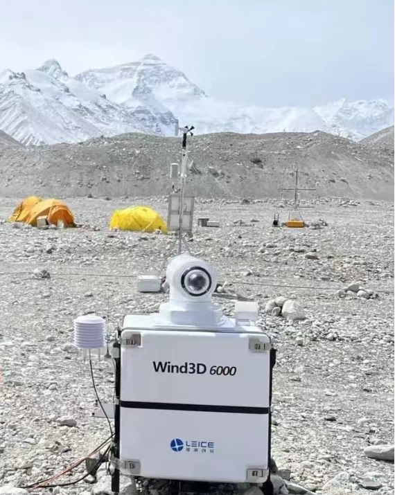
Doppler wind Lidar Wind3D 6000 conducts operational observations at Mount Everest Base Camp
The special natural environment of the Qinghai-Tibet Plateau has put forward extremely strict requirements on the instruments participating in the scientific expedition. The Doppler wind-measuring lidar developed by Qingdao Leice Transient Technology Co., Ltd. can be quickly installed and deployed under severe weather conditions such as high cold and low pressure. And carry out operational observation, the equipment runs stably, and the data is accurate and reliable. In order to fully provide guarantee services, Leice also cooperated with Ocean University of China to form an expert service team, and developed a series of customized data products for the needs of this scientific examination. The excellent products and professional services have been well received by the scientific research team.
In the future, Leice will continue to adhere to the development concept of "high focus, multi-dimensional innovation, integration of production and research, and mutual promotion", and further strengthen the independent research and development of key technologies around the country's major tasks and the development needs of new atmospheric and oceanic monitoring equipment. and conversion apps.